A Natural Partner to the Burke River Trail
The Upper Catawba River Paddle Trail flows through the heart of Burke County — the same corridor that the Burke River Trail (BRT) is working to connect by land. While BRT is a developing 40-mile hiking and biking trail that follows the Catawba River and dips into each of our Trail Towns, the paddle trail offers the on-the-water experience of that same journey.
Together, these two trails tell one story: Explore Burke — by land and by water.
An RTP (Recreational Trails Program) grant funded signage at access points along the Upper Catawba River Paddle Trail. While there is no single agency responsible for managing or promoting the trail, the signage provides consistent mapping, GPS coordinates, and distance information at each launch site.
Design work by Destination by Design (DbD) helped create clear, visible signage that can even be read from the water — including distances to the next access point.
Information on this page comes directly from those on-site signs.
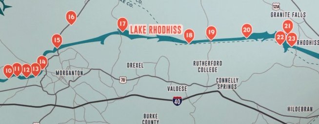
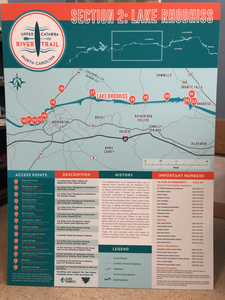
River Access Points (West to East)
Below are the identified access points along the Upper Catawba River Paddle Trail in Burke County:
10 – Watermill Road 35.743771, -81.772441
11 – Morganton Weir 35.738502, -81.732017
12 – Morganton Weir Dam Portage 35.739871, -81.729688
13 – Greenlee Ford 35.740853, -81.717968
14 – River Village 35.747091, -81.706037
15 – Rocky Ford 35.772230, -81.691189
16 – John’s River (Spur) 35.793163, -81.676864
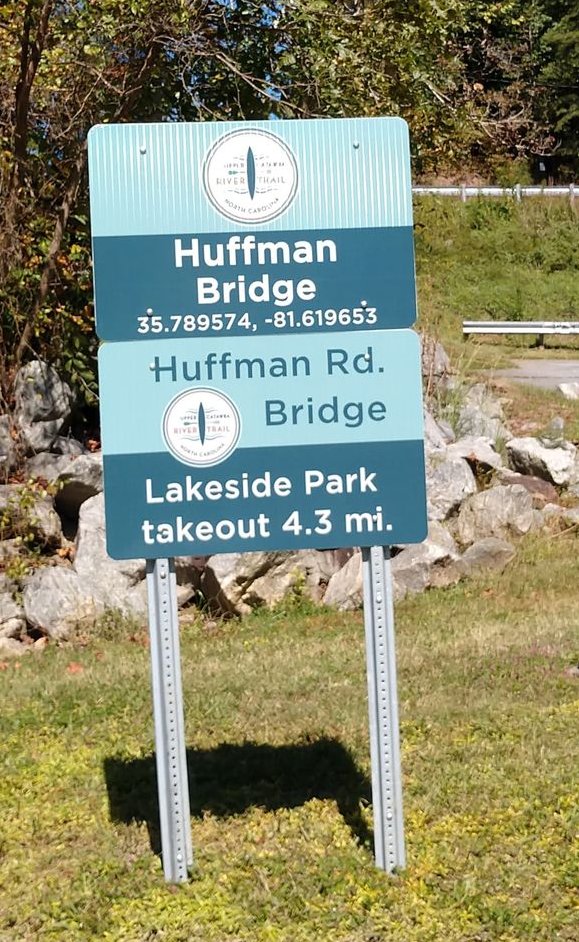
17 – Huffman Bridge 35.789574, -81.619653
18 – Valdese Lakeside Park 35.774120, -81.546513
19 – Castle Bridge 35.781818, -81.524949
20 – Connelly Creek 35.784041, -81.484686
21 – Lakeside Park in Granite Falls 35.786480, -81.440664
22 – Rhodhiss 35.771500, -81.442400
23 – Rhodhiss Portage 35.771300, -81.438000
Since the signage was created, a new access point has been added just west of Glen Alpine — North Bend Access – 35.72804504792933, -81.81132734417439
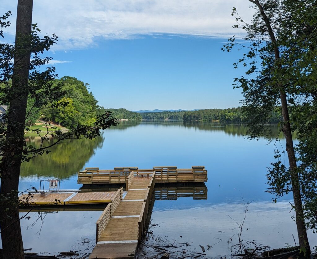
Access Point #18 — Valdese Lakeside Park — is a perfect example of how the Burke River Trail and the Upper Catawba River Paddle Trail intersect.
- The ADA-accessible paddle launch provides inclusive river access.
- The Valdese Greenway offers a 2-mile section of the Burke River Trail.
- Parking, restrooms, and park amenities make it an ideal “basecamp.”
You could:
- Paddle downstream and arrange a shuttle,
- Paddle out-and-back for a shorter adventure, or
- Combine a morning ride or hike on the Greenway with an afternoon float.
This is exactly the kind of land + water loop experience that makes Burke County unique.
More information is planning your float:
History of the Catawba River – The river is named after the Catawba Indians – “the people of the river.” Running for 220 miles, it starts in McDowell County and ends in SC as the Wateree River. Duke Energy is responsible for managing the reservoirs and regulating development on the river.
Looking Ahead: Combining Trails
As the Burke River Trail continues to develop, shared access points along the Catawba River create exciting possibilities:
- Ride into a Trail Town → paddle to the next access → return by trail
- Hike in the morning → float in the afternoon
- Visit multiple downtowns by land and water
- Support local outfitters, restaurants, and small businesses along the way
The Upper Catawba River Paddle Trail already exists.
The Burke River Trail is building the land connection.
Together, they create something bigger than either one alone.
More than a trail — it’s a connected experience.