
Map | Towns | Landowners | Crime on Trails
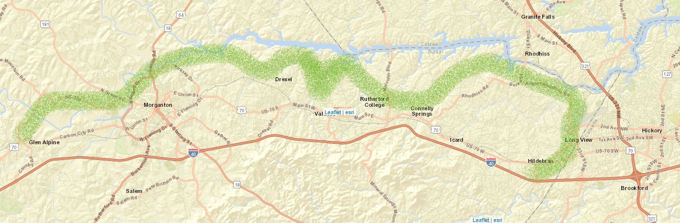
The Burke River Trail is being built in sections with willing landowners. The trail will be a mix of natural surface, paved greenway and sidewalks. The longest sections at this time are the Valdese Greenway and the Morganton Greenway. The trail will follow the south side of the Catawba River, dipping down to the small towns of Burke County.
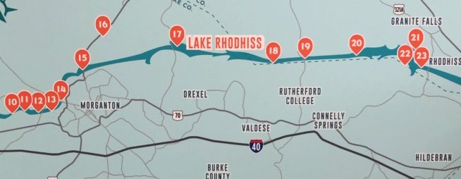
Current Access Points
Listed from West to East
| Trailhead | Address | Trail Type | Trail Name |
| Glen Alpine Downtown Park (picnic table, restrooms, track) | 401 Bridge St | 0.5 mile sidewalk Linville St-Catawba | Glen Alpine |
| Greenlee Ford (restrooms, dog park, playground) | 110 Greenlee Ford Rd | 3.8 mile 12-foot wide paved | Morganton Greenway |
| River Village (restrooms) | 300 Sanford Drive | 3.8 mile 12-foot wide paved | Morganton Greenway |
| Catawba Meadows Park (restrooms, playground) | 220 Catawba Meadows Drive | 3.8 mile 12-foot wide paved | Morganton Greenway |
| Rocky Ford Access (closed) | 541 Lenoir Rd | 3.8 mile 12-foot wide paved | Morganton Greenway |
| Drexel Downtown Park (picnic) | 118 Church St | 0.7 mile sidewalk Main St | Drexel |
| RO Huffman Center | 700 S Main | 0.7 mile sidewalk Main St | Drexel |
| McGalliard Falls Park (restrooms, picnic, sand volleyball) | 400 Falls Road | 2 mile 10-foot wide crushed cinder | Valdese Greenway |
| Valdese Lakeside Park (West) (restrooms, 14 miles of trail, pier, dog park) | 1149 Lake Rhodhiss Dr | 2 mile 10-foot wide crushed cinder | Valdese Greenway |
| Valdese Lakeside Park (East) | 1149 Lake Rhodhiss Dr | 0.55 mile 4-foot wide natural surface | Wildcat Way |
| Greenway Park (restrooms, picnic, playground) | 980 Malcolm Blvd | 0.6 mile sidewalk Malcolm Blvd | Rutherford College |
| Connelly Springs Town Hall (picnic shelter) | 1030 US-70 | — | — |
| Lakeside Reserve Neighborhood | Decker St | 0.1 sidewalk future | Connelly Springs |
| Horseshoe Park (playground, walking area) | 100 Carolina Ave | 0.15 natural | Rhodhiss |
| Long View Rec Center (walking track, playground) | 3107 2nd Ave NW | 0.3 mile track along road | Long View |
| Royal Park (play items. restrooms, track) | 202 S Center St | 0.7 mile sidewalk Center – Hwy 70 | Hildebran |
Connections to other trails
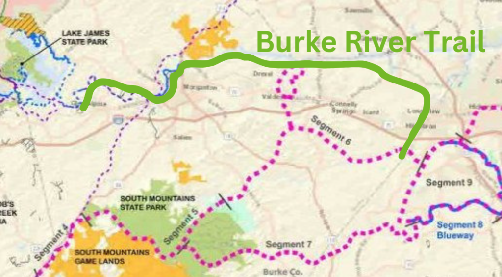
- Fonta Flora State Trail and Overmountain Victory State Trail – co-location Morganton Greenway
- Wilderness Gateway State Trail – co-located on Valdese Greenway and combined trailhead at Henry River Mill Village
- Hickory Trail – connection to Aviation Walk at Hickory Airport
- Upper Catawba River Paddle Trail – 6 access points on BRT
- Valdese Lakeside Park and Oak Hill Park & Forest – will pass through each large park
The Burke River Trail (lime green) will connect to 3 State Trails: Fonta Flora State Trail (purple dash west to Lake James), the Wilderness Gateway State Trail (large pink dot SMSP to Valdese) and the Overmountain National Historic Trail (pink/purple dash). Huge loop opportunity!
It also co-locates with many Upper Catawba River Paddle Trail access points.
Trail Status as of Winter 2026
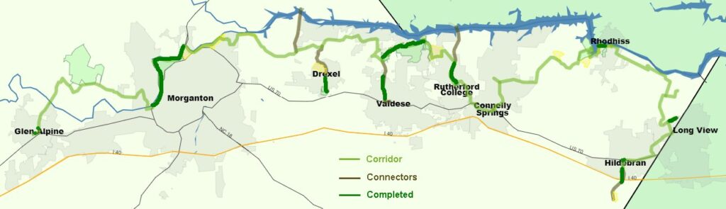
The trail corridor refers to the general area where the trail will be located, but the specific route within that area is still under consideration. We only work with willing land owners for trail location.
- Corridor Feasibility Study Complete
- Trail on the Ground – 2-mile Valdese Greenway, 0.5 mile on BCPS property in Valdese, 4-mile Morganton Greenway, 0.15 at Horseshoe Park Rhodhiss, and 2.5-mile of scattered sidewalk (blue)
- Next up – 0.5 mile in Rhodhiss, 4 miles in Morganton – getting closer
- Contacting landowners along other segments
Helpful Info
- Private Landowners and Trail
- Crime on Trails
- Greenways: Landowner Considerations In Making Land Available For Public Use
- Permits – Shoreline Activities
- Shoreline Management
- Sample Greenway Easement
Segments: Regional trails are often built in segments as stakeholders along the path are able to contribute and as right of ways are obtained.