

Take a trip around Burke County to see existing Burke River Trail trailheads and trail sections.
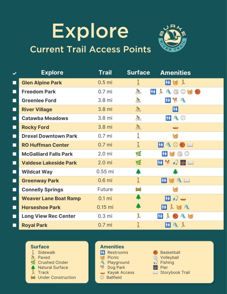
Extra Cool Map to scroll around and see Locations
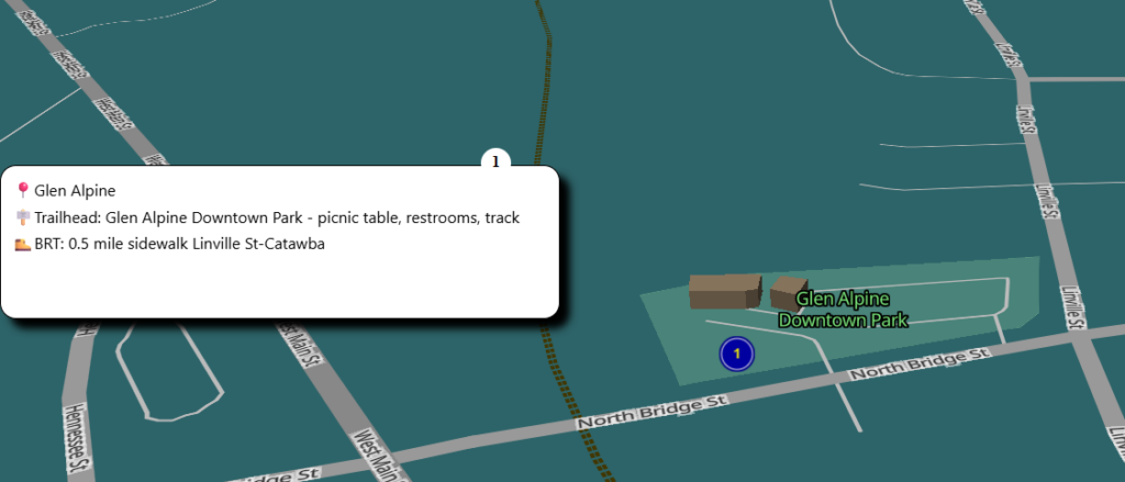
This is a section of that Extra Cool Map
Current Access Points
Listed from West to East
| Trailhead | Address | Trail Type | Trail Name |
| Glen Alpine Downtown Park (picnic table, restrooms, track) | 401 Bridge St | 0.5 mile sidewalk Linville St-Catawba | Glen Alpine |
| Greenlee Ford (restrooms, dog park, playground) | 110 Greenlee Ford Rd | 3.8 mile 12-foot wide paved | Morganton Greenway |
| River Village (restrooms) | 300 Sanford Drive | 3.8 mile 12-foot wide paved | Morganton Greenway |
| Catawba Meadows Park (restrooms, playground) | 220 Catawba Meadows Drive | 3.8 mile 12-foot wide paved | Morganton Greenway |
| Rocky Ford Access (closed) | 541 Lenoir Rd | 3.8 mile 12-foot wide paved | Morganton Greenway |
| Drexel Downtown Park (picnic) | 118 Church St | 0.7 mile sidewalk Main St | Drexel |
| RO Huffman Center | 700 S Main | 0.7 mile sidewalk Main St | Drexel |
| McGalliard Falls Park (restrooms, picnic, sand volleyball) | 400 Falls Road | 2 mile 10-foot wide crushed cinder | Valdese Greenway |
| Valdese Lakeside Park (West) (restrooms, 14 miles of trail, pier, dog park) | 1149 Lake Rhodhiss Dr | 2 mile 10-foot wide crushed cinder | Valdese Greenway |
| Valdese Lakeside Park (East) | 1149 Lake Rhodhiss Dr | 0.55 mile 4-foot wide natural surface | Wildcat Way |
| Greenway Park (restrooms, picnic, playground) | 980 Malcolm Blvd | 0.6 mile sidewalk Malcolm Blvd | Rutherford College |
| Connelly Springs Town Hall (picnic shelter) | 1030 US-70 | — | — |
| Lakeside Reserve Neighborhood | Decker St | 0.1 sidewalk future | Connelly Springs |
| Horseshoe Park (playground, walking area) | 100 Carolina Ave | 0.15 natural | Rhodhiss |
| Long View Rec Center (walking track, playground) | 3107 2nd Ave NW | 0.3 mile track along road | Long View |
| Royal Park (play items. restrooms, track) | 202 S Center St | 0.7 mile sidewalk Center – Hwy 70 | Hildebran |